If you’ve ever looked at Arizona on a map and thought “that doesn’t look that big,” you’re not alone, and you’re also not seeing the full picture. Flat maps distort land the further you get from the equator, and Arizona is one of the states that gets shortchanged the most. Once you look at the real numbers, Arizona turns out to be one of the largest states in the country, and bigger than most people ever guess.
This guide breaks down exactly how big Arizona is, how it stacks up against other states and countries, and what that size actually means if you’re driving across it, moving there, or just settling a debate with a friend.
Quick Answer: How Big Is Arizona?
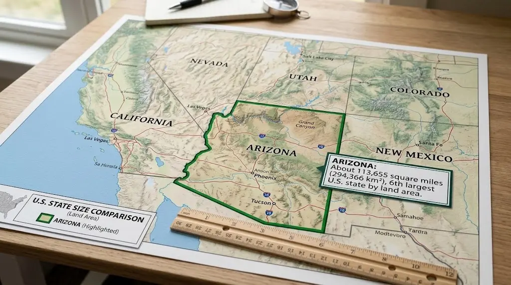
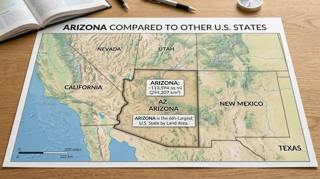
Arizona covers about 113,990 square miles (295,000 square kilometers), making it the 6th-largest U.S. state by total area. It sits just behind New Mexico and just ahead of Nevada. For comparison, all of New England plus the state of Pennsylvania could fit inside its borders.
Arizona at a Glance
| Fact | Detail |
| Total area | ~113,990 sq mi (295,000 km²) |
| National rank by size | 6th largest state |
| Length (north–south) | ~390 miles |
| Width (east–west) | ~335 miles |
| Capital | Phoenix |
| Statehood | February 14, 1912 (48th state) |
| Borders | Utah, New Mexico, Nevada, Sonora (Mexico); water border with California |
| Public/tribal land | ~85% of total area |
Arizona’s Total Land Area
Square Miles and Square Kilometers
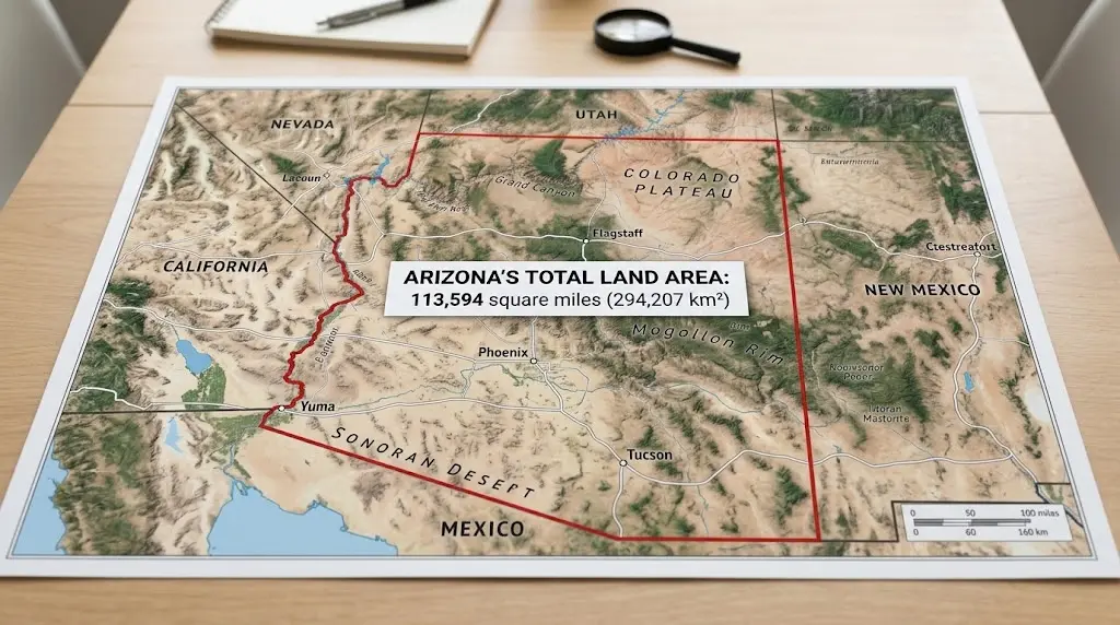
How big is Arizona? Arizona’s total area is approximately 113,990 square miles, or about 295,000 square kilometers. Of that, only around 0.3% is water, one of the lowest water percentages of any U.S. state, since Arizona is landlocked and largely desert.
To put that in perspective: Arizona is bigger than the entire United Kingdom, and if it were an independent country, it would rank as roughly the 73rd-largest nation in the world, just ahead of Ecuador.
Where Arizona Ranks Among U.S. States
Arizona is the 6th-largest state in the country by land area. Here’s how it lines up against the states closest to it in size:
| Rank | State | Approx. Area (sq mi) |
| 4 | Montana | 147,040 |
| 5 | New Mexico | 121,590 |
| 6 | Arizona | 113,990 |
| 7 | Nevada | 110,570 |
| 8 | Colorado | 104,090 |
Arizona is larger than every state on the East Coast combined with room to spare, a fact that surprises a lot of people who assume the biggest states are all clustered in the middle of the country.
Arizona’s Physical Dimensions
North-to-South and East-to-West Distance
Arizona stretches roughly 390 miles at its longest point (north to south) and about 335 miles at its widest (east to west). That’s a large enough footprint that weather, elevation, and even scenery can change dramatically depending on where you are, from the pine forests of Flagstaff at over 7,000 feet to the low desert around Phoenix and Yuma.
Geographic Center of Arizona
The geographic center of the state sits in Yavapai County, about 55 miles east-southeast of Prescott. If you wanted to stand in the literal middle of Arizona, that’s roughly where you’d need to go.
Why Maps Distort Arizona’s Real Size
The Mercator Projection Problem
The Mercator projection is a map style that flattens the round Earth onto a flat screen by stretching land more and more the farther it is from the equator. Most digital maps, including the default view on Google Maps, use this projection. It’s convenient for navigation, but it comes with a tradeoff: land near the poles looks much larger than it really is, while land closer to the equator looks smaller.
The practical effect is that countries and states near the middle of the map (closer to the equator) look smaller than they really are, while places near the top or bottom look artificially huge. Arizona sits in that “compressed” zone, so on a standard map, it often looks smaller relative to countries like Greenland or Russia than it actually is in real life.
What Arizona Looks Like at True Scale
Tools like thetruesize.com correct for this distortion by letting you drag a country’s true outline over other regions. When you do that with Arizona, the results are surprising:
- Greenland, which looks hundreds of times larger than Arizona on a standard map, is actually only about 6.8 times Arizona’s size.
- Germany is only about 1.2 times larger than Arizona.
- Arizona is actually larger than the United Kingdom, Greece, Iceland, and New Zealand, though smaller than France (see table below).
The takeaway: don’t trust a flat map to judge Arizona’s real size. The numbers tell a very different story.
Arizona Compared to Other U.S. States
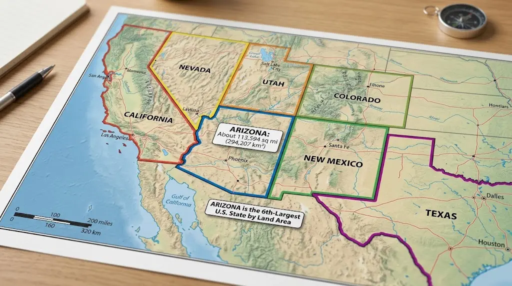
Numbers on their own can be hard to visualize, so here’s how Arizona compares directly to a few states people ask about most.
| Comparison | Result |
| Arizona vs. California | Arizona is about 73% the size of California |
| Arizona vs. Texas | Texas is roughly 2.3 times larger than Arizona |
| Arizona vs. Nevada | Arizona is slightly larger than Nevada |
| Arizona vs. New Mexico | New Mexico is slightly larger than Arizona |
Arizona vs. California
California is the third-largest U.S. state, but Arizona isn’t far behind, it’s about three-quarters the size of its western neighbor. The two states share a border along the Colorado River, and together they cover a huge stretch of the American Southwest.
Arizona vs. Texas
Texas dominates most size conversations, and for good reason: it’s more than double Arizona’s area. But Arizona still holds its own as the 6th-largest state overall, which puts it ahead of well-known states like Colorado, Oregon, and Wyoming.
Arizona vs. Nevada and New Mexico
Arizona is sandwiched almost perfectly between its two closest rivals in size. New Mexico edges it out for 5th place, while Arizona edges out Nevada for 6th. The three states combined make up a massive, mostly desert region of the Southwest.
Arizona Compared to Countries
Because Arizona is so large, how big Arizona is is often easier to understand by comparing it to entire countries rather than other U.S. states.
| Country | How It Compares to Arizona |
| United Kingdom | Arizona is about 1.2 times larger |
| Germany | Germany is about 1.2 times larger |
| France | France is about 1.8 times larger |
| Greece | Arizona is about 2.2 times larger |
| Iceland | Arizona is about 2.8 times larger |
| New Zealand | Arizona is about 1.1 times larger |
Arizona vs. the United Kingdom
This is one of the most cited comparisons for a reason: Arizona is genuinely bigger than the entire United Kingdom, England, Scotland, Wales, and Northern Ireland combined. A single U.S. state outsizing an entire nation of over 67 million people is a good way to grasp just how much land Arizona covers.
Arizona vs. Greece, Iceland, and Germany
Arizona is more than twice the size of Greece and nearly three times the size of Iceland. Even Germany, one of the larger countries in Western Europe, is only about 20% bigger than Arizona. These comparisons make it clear that “state” doesn’t always mean “small.”
Why Is Arizona This Size? A Quick History
Arizona’s borders weren’t always where they are today. Most of the state’s northern and central land came from the Mexican Cession of 1848, when Mexico ceded a huge stretch of the Southwest to the U.S. after the Mexican-American War. But the southern strip, including present-day Tucson, wasn’t part of that deal. It was added through the Gadsden Purchase of 1853–54, when the U.S. paid Mexico $10 million for roughly 29,670 additional square miles, largely to clear a path for a southern transcontinental railroad route.
Those two land deals essentially finished the outline of Arizona as we know it today. The territory wasn’t officially admitted as the 48th state until February-14-1912, making it the last of the contiguous states to join the Union.
How Long Does It Take to Drive Across Arizona?
Size on paper is one thing, size behind the wheel is another. Based on Arizona’s roughly 390-mile length and 335-mile width, here’s a rough idea of drive times at highway speeds (these are estimates and will vary with traffic, weather, and route):
| Route | Approx. Distance | Approx. Drive Time |
| Phoenix to Flagstaff | ~145 miles | 2–2.5 hours |
| Phoenix to Tucson | ~115 miles | 1.5–2 hours |
| North-to-south (full state) | ~390 miles | ~6 hours |
| East-to-west (full state) | ~335 miles | ~5 hours |
If you’re planning a road trip, budget extra time. Arizona’s elevation changes are significant, you can go from desert floor to mountain passes in under two hours, and weather in the higher elevations (especially near Flagstaff in winter) can slow things down.
How Much of Arizona Is Public and Protected Land?
Those long drive times start to make more sense once you know what fills the space in between. One reason Arizona feels so vast is that most of it isn’t privately developed. Roughly 85% of Arizona’s land is made up of national forests, national parks, recreation areas, wildlife preserves, and tribal land, including large Native American reservations like the Navajo Nation, which alone covers more than 17,000 square miles across Arizona, Utah, and New Mexico.
This is a major reason Arizona’s population is concentrated in just a few metro areas, Phoenix, Tucson, and a handful of smaller cities, while huge stretches of the state remain open desert, forest, or protected land.
Size vs. Population: Why Arizona Feels So Open
Arizona is large, but it isn’t especially crowded. As of the most recent available population estimates, the state is home to roughly 7 million people, with about 60% of residents living in Maricopa County alone (home to Phoenix). Check the U.S. Census Bureau for the latest figure, since population totals shift more often than land-area data. That works out to a population density far lower than most Americans expect for a state this size, especially once you account for how much land is public or protected rather than residential.
Phoenix itself is the 5th-largest city in the U.S. by population and one of the largest by land area, but drive an hour outside any major Arizona city and you’ll typically find open desert rather than suburbs. That’s the size-to-population gap in action.
FAQs: How Big Is Arizona?
Is Arizona the 6th-largest state in the U.S.?
Yes, Arizona ranks 6th by total land area, coming in behind Alaska, Texas, California, Montana, and New Mexico, and just ahead of Nevada.
Is Arizona bigger than the United Kingdom?
It is. Arizona is about 1.2 times larger than the entire United Kingdom, which is a good way to grasp just how much land one U.S. state can cover.
How Big Is Arizona in Square Miles?
Arizona covers approximately 113,990 square miles, or about 295,000 square kilometers.
How long does it take to drive across Arizona?
Budget around 6 hours for the north-to-south drive and about 5 hours east to west at highway speeds. Those numbers don’t include stops, traffic, or the mountain weather you can run into near Flagstaff, so it’s worth padding your schedule a bit.
What states border Arizona?
Arizona borders Utah to the north, New Mexico to the east, and Nevada to the northwest, plus the Mexican state of Sonora to the south. It also shares a water border with California along the Colorado River.
How much of Arizona is desert?
Less than you might assume. The Sonoran Desert does cover a large share of the southern and central parts of the state, but northern Arizona is home to some of the largest ponderosa pine forests in the country, along with mountains and canyons that don’t fit the “all desert” stereotype at all.
If you’re interested in more practical size measurements, check our military ammo can size chart for standard dimensions and capacities.
Summary: The Real Size of Arizona
How big is Arizona? It covers about 113,990 square miles, making it the 6th-largest state in the country, bigger than the United Kingdom, Greece, and Iceland, and only slightly smaller than Germany. Standard maps make it look smaller than it is, thanks to the Mercator projection, but at true scale, Arizona is one of the most spacious states in America, with most of its land made up of protected desert, forest, and tribal territory rather than cities. Whether you’re comparing it to another state, another country, or planning a road trip across it, one thing is clear from the numbers alone: Arizona earns its place among the country’s biggest states, map distortions aside.
Sources
- Geography of Arizona,Wikipedia (land area, dimensions, geographic center)
- List of U.S. states and territories by area,Wikipedia (state size rankings)
- Gadsden Purchase,Britannica (historical land acquisition)
- U.S. Census Bureau (population estimates,check census.gov for the current figure)